From Utrecht to Rotterdam, Europe’s largest port

Broken bridges on the Vecht River forces us to take the Amsterdam Rhine Canal from Weesp to Utrecht. This huge canal provides commercial traffic an easy and quick connection to the Rhine. Given the low water levels on the Rhine we were expecting few barges to make that journey as they could not carry a full load. That seemed to be the case.

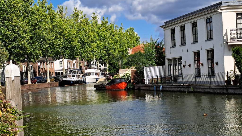
Utrecht is the country’s fourth largest city, with a population of 378,000. There is evidence of human settlement dating to the stone age. In 50 CE the Romans built a fort here, at a point where the Rhine was easily crossed. It was part of its northern defenses against Germanic tribe intrusion. By around 1100 it was called ‘Trecht” from the Roman Traiectum. “U” was added to denote the “uut,” “downriver” in Old Dutch, to distinguish it from a crossing on the Maas. Thus the city came to be called Utrecht.

The first of only three non-Italian popes

The Union of Utrecht was signed here in 1579, a cornerstone of the Dutch Republic. At that time Utrecht was the Netherland’s most important city, surpassed by Amsterdam in the next century. The first church in the city was built in the 7th century under Dagobert. Utrecht then became a center of Christianity leading to the papacy of Utrecht-born Adriaan Florenszoon Boeyens as pope in 1522. There was not another non-Italian pope until John Paul II. The Bishops of Utrecht under feudalism exercised temporal power as the overlord, collecting rent and ruling as they saw fit.

Construction of the present cathedral, most often referred to as the Dom but also known as the Cathedral of St Michael, began in 1254 on the site of a Romanesque church lost in a fire. The Dom’s tower remains with us but the nave came down in the storm of 1674. The flying buttresses needed for its support were never built due to financial constraints. The building was sealed afterwards, the area occupied by the nave turned into Dom Plaza, as it remains today.

Inside it is light and airy and expansive. The windows are large and tall but there is no stained glass. It is plainly decorated as is common for Protestant churches in this country.

After a 45 minute wait at a lock we entered the De Lek River, which becomes the Nieuwe Maas near Rotterdam. Along the way we encounter huge barges, some carrying containers stacked four or five high, the pilot houses hydraulically lifted so the pilots can see. As we entered Rotterdam harbor we are rocked by high speed water taxis zooming by. We swing into the big wakes, cutting into them at a 45 degree angle.

More on Rotterdam coming up.

Uncertainty: the everyday reality of boating

From deep in the heart of Friesland we set off early on a twenty hour journey to the tiny town of Weesp on the River Vecht. There we are joined by nephews for a legacy tour starting in Weesp, to Utrech, Rotterdam, den Haag, Haarlem and Amsterdam.

We stayed one night on the Eems River. Arriving around 6 p.m. meant that we would have a hard time finding a mooring at all. The first set of moorings were full, but as usual if the boaters eliminated unnecessary gaps we could have easily fit. We had to go 6 kilometers up the river before we found a mooring in a small park on a curve- that ook more than 30 minutes. Curves are harder to moor to since your bow is farther from the land, making it harder to tie to a bollard. The sailboat’s bowsprit stuck far out, giving us an extra obstacle. Fortunately there were posts to moor to – you never know until you get there. Sometimes there are just rings, meaning you have to get off the boat to attach to the shore. This can be difficult if the wind is pushing you away from the land Here we were able to lasso both the front and aft posts. With posts you have to go around twice, or the lines ride up and off.

There were several locks along the way, filled end to end with boats. It’s summer so the Dutch hit the waterways, even in the less than ideal weather on offer. The lock meister packs them in! You always wonder if some new boater, or a rental boats, will lose control of their vessel. All the experienced boats are on alert.

Looking ahead we could not be certain if the weather would hold. Already we had a problem getting off a mooring with strong winds pinning us to the dock, our bow thruster not there to give us a lateral boost. From the Eems we headed early in the morning into wind and rain, but fortunately everything calmed down once we entered the canal leading to the lock. This made entering the lock much easier, so we were able to gaze upon the beautiful old Muiden Castle.

Muiden, NL Castle, watercolors

Our next uncertainty is the availability moorings in Wessp. Just past the second bridged we found the only one available. Lady Luck overruled Sir Bad Luck us once again. The next morning everyone left so we moved farther from the bridge to avoid the fumes of the boats waiting for the bridge to open as they say just a meter away.

Moored in the center of Weesp

If you’ve not had the pleasure, include Weesp on a tour of small Dutch towns. It’s not far from Amsterdam and can be visited in just a few hours. There are restaurants along the river and a brewery located in a de-consecrated church, with lots of very Dutch architecture. In summer there are flowers galore.

Workum and Hidelopen: Two charming villages in Friesland Province, Netherlands

In a country dotted with charming houses, these two tiny, ancient coastal villages offer great examples of small brick fisherman’s houses. Hindelopen opens directly to the Ijsslemeer, an inland sea about the size of Lake Pontchartrain. Workum sits about 2 kilometers off the coast. Both are protected by dikes and locks. The Ijslemeer was formerly part of the North Sea. In the 1950’s dikes and locks were added to control the incursion of the North Sea, after a storm in the early 1950’s killed thousands. If the dikes fail, all the land along the Ijsslemeer are in danger.

You are treated to photo ops nearly everywhere you go.

Workum dates to prior to 1399 when it was awarded city rights. Much of the housing dates from the 16th century. Brick is by far the most widely used building material here as elsewhere in the Netherlands. The roofs are tile, not thatch. Thatch is seldom seen in urban settings due to the fire hazard. There are about 4400 residents of the town.

Hindelopen is smaller than Workum, with a mere 900 inhabitants, and even older. It received city right in 1225. In 1368 it became a member of the Hanseatic League, the major European trading association of the epoch. Its strong sea trade contributed to the development of its own language, a mixture of Frisian, English, Danish and Norwegian, as well as the luxurious costumes and homes we see today. Today aside from Dutch and English many speak the modern version of Frisian.

Along the harbor are two Vis (fish) shops serving deep fried cod and super fresh herring served raw with optional onions. Dutch sushi, I call it. There’s an old fishing vessel at the adjacent dock providing covered seating, but on this breezy, sunny day we sat outside in the sun enjoying the battered fish and the always excellent fries.

Bridge in a park

Nearby is the Museum Hindelopen. It provides excellent commentary with a point and click device, available in multiple languages. The ground floor focuses on folk costume, the second a fully furnished medieval room. Unfortunately it’s short on the history of this fishing village.

Ice cream boat!

Boats and bikes: the Dutch are known for these modes of transport. Bikes are in daily use, while boats are good weather friends. The infrastructure for both is extensive. For boats its opening bridges, locks, moorings, marinas, parts and repairs, waterside restaurants. In Grou a grocery store has a couple of spots for boats so you can do your shopping easily, around the corner from free water. And now I have seen it all. An ice cream boat!

Ding ding ding! You can hear a long ways on the water so the bells were crystal clear from the far side of the island where we were moored near Woudsen. They showed up a minute or two later. Most everyone ordered. Of course we had to join in!

By small boat to Appingedam and Delfzij

Appingedam and Delfzijl are located in the less visited far northeast of the Netherlands. Delfzijl sits on the shore of the bay into which the Eems River empties, connecting it to the North Sea. Appingedam is a few kilometers inland. Both are served by the Eemscanal, a large barge capable canal.

Appingedam picturesque municipal harbor is in the center, reached through a small lock and then by a tiny canal. The harbormaster came to open the bridge and with very basic English guided us to a back in box. Our bow thruster having failed in high winds just as we arrived at the lock, getting into a narrow box just a half meter wider that our boat can be a bit of a challenge. We managed to get him to allow us to stay where it is easier to dock.

Appingedam has been inhabited since prehistoric times, coming into history in the 13th century. It was located on the Delf River, now called the Damsterdiep. The name ‘Appingedam’ refers to the dam built on the Appe (aka Apt) In 1327. It was then a seaport with good access via the river, becoming a trade hub for destinations in Germany and the Baltic. It was then part of Frisia (Friesland), a region of Frisia called Fivelingo. Nowadays it sits between two canals, completely surrounded by water.

Its famous hnging kitchens

In 1536 Appingendam and Gronigen went to war over trade. Appingendam was destroyed, losing it’s position as a trade hub. It was not dead altogether, however. It regained enough economic health that there were funds to build the City Hall in the 1630’s. By the late 1800’s cattle, flour, oil and five breweries provided employment and growth.

Delfzijl is now the more important of the two towns, being the fifth largest port in the Netherlands. “Delftzijl” refers to a fortified lock on the old Delf canal that connected the rivers Fifel and the Eems. It has been a major port since the Middle Ages. There were six bastions, built in 1591. The town has been the focus of several battles involving the Spanish and French, and in WW2, the Nazis. Today, despite being a fairly important port, the town shows signs of economic stress, with a noticeable number of empty commercial spaces awaiting tenants.

The bastions of 1591

We had lunch at Cafeteria Rex. It was doing good business as we waited. It’s set up as a lunchroom with the grill behind the bar so you can watch them work. The lekkerbek (deep fried cod) was much less expensive than in Gronigen, at €7 versus €10, and bitterballen likewise, and just as good. Bitterballen are a breaded and then deep fried snack made with a stew thickened with roux. In this beef stew they add onions, salt, pepper, parsley and nutmeg.

The town is protected by a 9 meter/ 30′ dike, sluices and a pumping station. At low tide the sluices open to drain the land. The pumps are used if the low tide is too high to allow for gravity drainage.

The Uitwierde Church has a free standing tower circa 1200. The church sits on an artificial mound dating from well before the construction of dikes. There’s an old windmill, Mill Adam. The Adam is a corn mill. Originally, the Adam was was paired with the Mill Eva. Adam Mill is now an art exposition space. No one knows if Adam Mill misses Eva Mill. https://www.visitgroningen.nl/en/locations/eemsdelta/blissfully-happy-in-delfzijl/culture-in-delfzijl

Uitwierde Church

There’s a monolith tomb dating to 3400 BCE.

The Almshouses of Gronigen

Pope Steven V issued a decree in 816 requiring every bishop to establish an almshouse, (‘gasthuis’ in Dutch). In the Middle Ages these houses served the sick, the poor, and pilgrims. One of the almshouses in Gronigen was the first in Europe to provide housing for the mentally ill, allowing the public to peep through the windows on Sundays to observe their behaviors.

Today you can visit the courtyards and gardens of many of the 30 almshouses, which largely remain occupied by those who qualify for assistance. We visited a dozen or so in a two hour walk around town using the “Almhouses” booklet we bought from the tourist information center. Here are some comments about a few of the houses along with some photos of the interesting old architecture and lovely gardens.

Heiligen Geesthuis is the oldest almshouse, founded in the 12th century by the Order of the Holy Spirit Masters. There are five inner courtyards. There was a hospital. The tower houses the oldest bell in Gronigen.

The Armhuiszitten Convent  managed several almshouses while also distributing food to the poor, starting in the 15th century. The Pelstergasthuis was founded as accommodation for pilgrims. The Pepergasthuis, dedicated to Saint Gertrude, served pilgrims in her heavenly portfolio. Later the house also served the mentally ill, the poor and elderly, leaving the physically ill to others. The ‘Madhouse Fair,’ as they called it, occurred every Sunday.

St AnthonyGashuis took in plague victims. It was also located outside the city walls in an effort to quarantine. However they also took in the poor, whom no doubt were allowed to circulate in the town at will. They did not yet have germ theory obviously.

Juffer Tette Alberdagasthuis
St Anthony Gasthuis

In 1479 Synerd de Mepshen founded Mepshengasthuis/Sint-Annengasthuis in honor of Saint Anna to house 15 people. She was the window of Mayor Otto ter Hansouwe.

Red dots show the almshouses you can visit

On a sunny day you can get some great photos of the picturesque gardens and the medieval architecture.

Once upon a zee

Before the construction of Flevoland, Genemuiden was a port on the Zuiderzee. It was granted city rights all the way back in 1275. Nothing remains from before 1866, unfortunately, when fires destroyed the town after haystacks caught fire. To this day there is no smoking permitted on that street, probably the only such designation in the EU.

Judging by the 5 churches in the town there’s a lot of interest in religion in the town, but of course actual attendance is another matter. All the churches are Protestant in this northeast edge of the country’s Bible-belt. In some areas of the Bible belt people adhere to old fashioned clothing. I do not see that here.

We arrived on Ascension day to find closures and reduced hours. The Eet Cafe, for example, was open but only provided beverages. Few people were out on the streets. It’s a national holiday, which no doubt accounts for the lack of activity, rather than Ascension day, as that’s a Catholic celebration. Unfortunately the harbor meister did stop by for our payment.

We came here to have electricity as the overnight temperature was to drop to 3c, about 38f. We use a small electric heater when plugged into shore power, otherwise we have a diesel heater. We do not run the diesel heater at night to avoid CO accumulation. It takes the chill off in the morning when our indoor temperatures drops to around 15-16c, in the low 60’s.

Floor mats made from bull rush reed that grew on the shoreline of the Zuiderzee was a principal product of the town. When Flevoland cut off the sea the bull rush was unable to survive the change. Now they import coconut fiber from India to make the mats and have expanded to a wide range of materials and products. Most of the town’s employment come from the large factories.

We learned this and more at the Tapijtmuseum, https://www.tapijtmuseum.nl/over-het-museum after a good kip (chicken) sate at the friendly Eet Cafe Schippers. In the days of bull rush weaving, men waded into the reeds wearing clogs, a leather shin protector, ordinary clothes and a scythe to harvest the reed. This occurred in July and August but still the water is cold if you are in it all day. They could harvest up 100 bundles a day per person. At 3 p.m. they put the reeds out to dry in the wind and sun, after which the reeds were processed into mats. From the early hand weaving they have progressed to the most modern, computer-run equipment.

Processing the harvest
Operating the old electric loom
Poster at the Eet Cafe

Two loom operator’s joined our guide, who explained how the historic looms worked. Among their collection is a Jacquard loom, patented by the Frenchman of that name in 1802. It uses punch cards to weave complex designs, now done by computers. Each pass of the loom moves another card into place. It’s introduction revolutionized the industry.

Queen Maxima wearing her maxed out hat inaugurated the reopening of the museum in September 2026 following its renovation. The Queen walked on an orange carpet laid for the occasion.

Queen Maxima

After our friendly retired civil engineer tour guide finished up with the Dutch couple that’d joined us, we were invited to have a coffee. The entire staff, being two women and the tour guide after he wrapped up, joined us. They wanted to know where we were from and where we were going. They made us feel right at home. We always find a way to compliment our host country. Certainly the Netherlands has much to offer.

And then we were off to fight the wind at the municipal marina’s water point dock before mooring once again at the small haven just outside town.

The Green Church

After several days visiting friends we set off again, despite the weather having turned to gray skies and 30 kph winds. One lock and a bit of cruising brought us to the moorings at the Green Church.

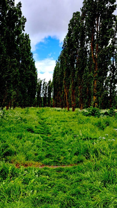
Set in Flevoland, one of the Netherland’s recovered land provinces, the Green Church is formed by Italian poplar trees forming the outline Notre Dame of Reims. There is no altar or anything else having to do with a church. An artist named Marinus Boezum (1938) came up with the idea in 1978, calling it a “Gothic Growing Project.” With the support of the engineers of the Rijksdienst Ijseelmeerpolders, he planted the 178 poplars you see today. The Green Church is deemed to be Gothic in style, but only as that is style of the church in Reims.

The Green Cathedral

There are concrete “ribs” connecting the trees, referencing the ceiling vaults. There are circles of sea shells around the trees, reminding of the sea under which this land stood just 50 years ago.

There were a number of large scale art projects in Flevoland, of which this is one. They are termed “Land Art,” a concept imported from the United States. The same artist created an identical “cathedral” on the neighboring plot, using oak and beech hedges.

Flevoland is the largest reclaimed land section in the world. It sits some 6 meters below sea level. Cornelius Levy was the chief engineer of the project which removed the Zuiderzee. The section in which the Cathedral is located was built between 1959 and 1968. Shipwrecks unearthed date to the 16th century. They have been left in place, their locations marked by blue and white striped polls.

Boezum went to art school in Utrecht. He worked as an artist in the 1950s. In the 1960s his work became more three dimensional, including sculptures and works in public spaces. He was influenced by the 1960 movements Nouveau Réalisme in Europe and Pop Art in America, and is one of the first Dutch conceptual artists.

He has done many installations and video projects. Other than the Green Cathedral, which I find mildly interesting especially in its current unkempt state, I have no experience with his work, and do not know if it would make me yawn, as so many installation and video projects do.