Category: Blog

  • By small boat to Appingedam and Delfzij

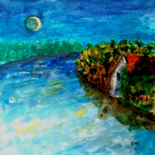
    Appingedam and Delfzijl are located in the less visited far northeast of the Netherlands. Delfzijl sits on the shore of the bay into which the Eems River empties, connecting it to the North Sea. Appingedam is a few kilometers inland. Both are served by the Eemscanal, a large barge capable canal.

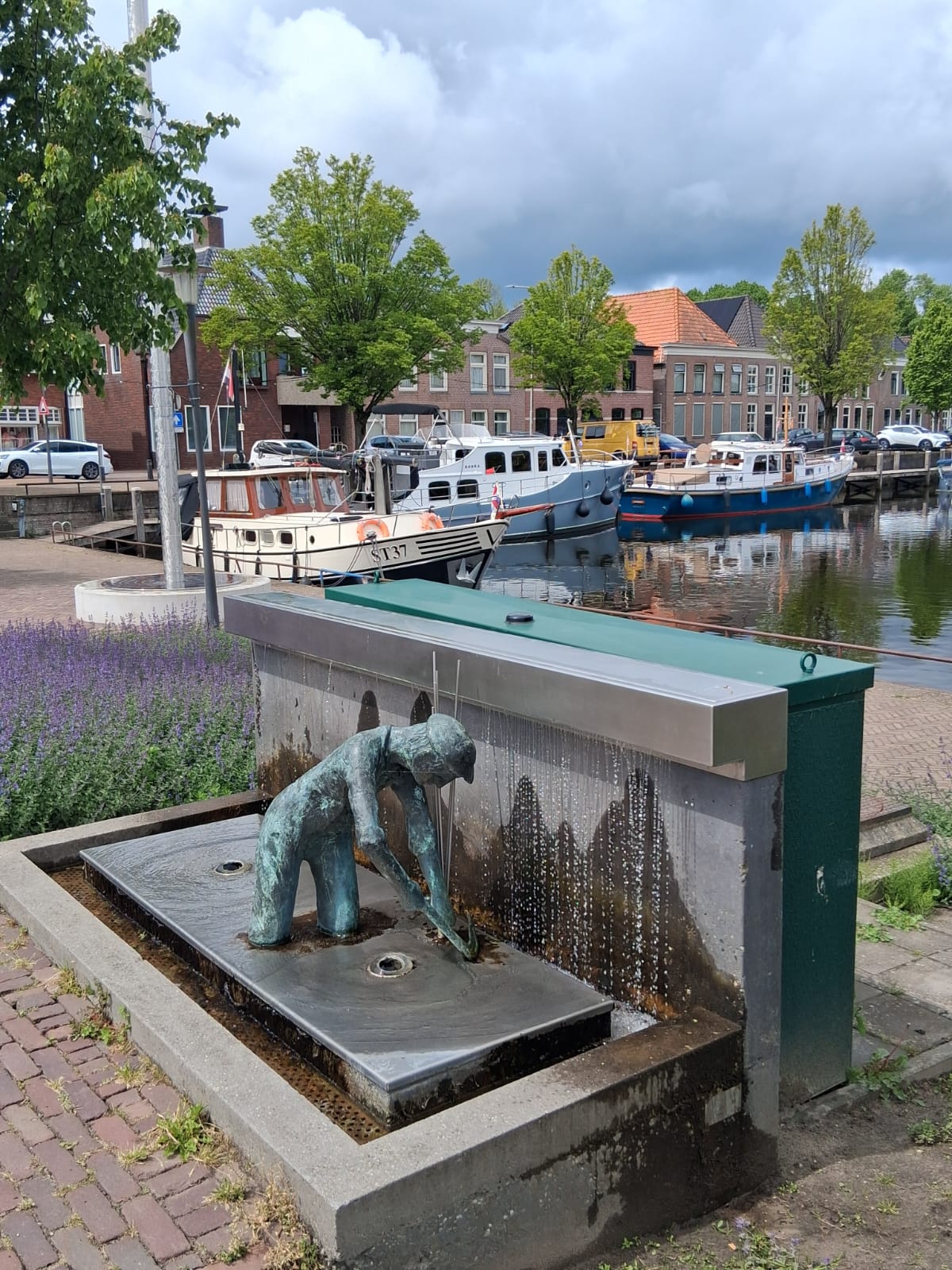
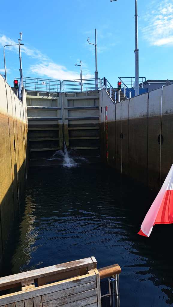
    Appingedam picturesque municipal harbor is in the center, reached through a small lock and then by a tiny canal. The harbormaster came to open the bridge and with very basic English guided us to a back in box. Our bow thruster having just failed in high winds just as we arrived at the lock, getting into a narrow box just a half meter wider that our boat can be a bit of a challenge. We managed to get him to allow us to stay where it is easier to dock.

    Appingedam has been inhabited since prehistoric times, coming into history in the 13th century. It was located on the Delf River, now called the Damsterdiep. The name ‘Appingedam’ refers to the dam built on the Appe (aka Apt) In 1327. It was then a seaport with good access via the river, becoming a trade hub for destinations in Germany and the Baltic. It was then part of Frisia (Friesland), a region of Frisia called Fivelingo. Nowadays it sits between two canals, completely surrounded by water.

    It’s famous hnging kitchens

    In 1536 Appingendam and Gronigen went to war over trade. Appingendam was destroyed, losing it’s position as a trade hub. It was not dead altogether, however. It regained enough economic health that there were funds to build the City Hall in the 1630’s. By the late 1800’s cattle, flour, oil and five breweries provided employment and growth.

    Delfzijl is now the more important of the two towns, being the fifth largest port in the Netherlands. “Delftzijl” refers to a fortified lock on the old Delf canal that connected the rivers Fifel and the Eems. It has been a major port since the Middle Ages. There were six bastions, built in 1591. The town has been the focus of several battles involving the Spanish and French, and in WW2, the Nazis. Today, despite being a fairly important port, the town shows signs of economic stress, with a noticeable number of empty commercial spaces awaiting tenants.

    The bastions of 1591

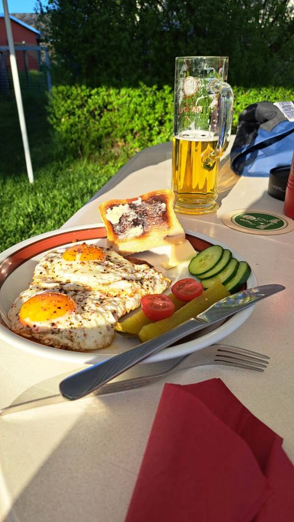
    We had lunch at Cafeteria Rex. It was doing good business as we waited. It’s set up as a lunchroom with the grill behind the bar so you can watch them work. The lekkerbeck (deep fried cod) was much less expensive than in Gronigen, at €7 versus €10, and bitterballen likewise, and just as good. Bitterballen are a breaded and then deep fried snack made with a stew thickened with roux. In this beef stew they add onions, salt, pepper, parsley and nutmeg.

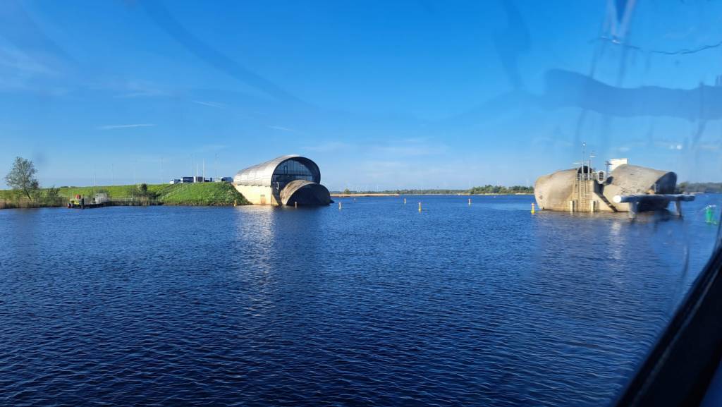
    The town is protected by a 9 meter/ 30′ dike, sluices and a pumping station. At low tide the sluices open to drain the land. The pumps are used if the low tide is too high to allow for gravity drainage.

    The Uitwierde Church has a free standing tower circa 1200. The church sits on an artificial mound dating from well before the construction of dikes. There’s an old windmill, Mill Adam. The Adam is a corn mill. Originally, the Adam was was paired with the Mill Eva. Adam Mill is now an art exposition space. No one knows if Adam Mill misses Eva Mill. https://www.visitgroningen.nl/en/locations/eemsdelta/blissfully-happy-in-delfzijl/culture-in-delfzijl

    Uitwierde Church

    There’s a monolith tomb dating to 3400 BCE.

  • The Almshouses of Gronigen

    Pope Steven V issued a decree in 816 requiring every bishop to establish an almshouse, (‘gasthuis’ in Dutch). In the Middle Ages these houses served the sick, the poor, and pilgrims. One of the almshouses in Gronigen was the first in Europe to provide housing for the mentally ill, allowing the public to peep through the windows on Sundays to observe their behaviors.

    Today you can visit the courtyards and gardens of many of the 30 almshouses, which largely remain occupied by those who qualify for assistance. We visited a dozen or so in a two hour walk around town using the “Almhouses” booklet we bought from the tourist information center. Here are some comments about a few of the houses along with some photos of the interesting old architecture and lovely gardens.

    Heiligen Geesthuis is the oldest almshouse, founded in the 12th century by the Order of the Holy Spirit Masters. There are five inner courtyards. There was a hospital. The tower houses the oldest bell in Gronigen.

    The Armhuiszitten Convent  managed several almshouses while also distributing food to the poor, starting in the 15th century. The Pelstergasthuis was founded as accommodation for pilgrims. The Pepergasthuis, dedicated to Saint Gertrude, served pilgrims in her heavenly portfolio. Later the house also served the mentally ill, the poor and elderly, leaving the physically ill to others. The ‘Madhouse Fair,’ as they called it, occurred every Sunday.

    St AnthonyGashuis took in plague victims. It was also located outside the city walls in an effort to quarantine. However they also took in the poor, whom no doubt were allowed to circulate in the town at will. They did not yet have germ theory obviously.

    Juffer Tette Alberdagasthuis
    St Anthony Gasthuis

    In 1479 Synerd de Mepshen founded Mepshengasthuis/Sint-Annengasthuis in honor of Saint Anna to house 15 people. She was the window of Mayor Otto ter Hansouwe.

    Red dots show the almshouses you can visit

    On a sunny day you can get some great photos of the picturesque gardens and the medieval architecture.

  • A Visit to Closeburn Castle (video slide show)

    A Visit to Closeburn, the Kirkpatrick Family Castle
  • Once upon a zee

    Once upon a zee

    Before the construction of Flevoland, Genemuiden was a port on the Zuiderzee. It was granted city rights all the way back in 1275. Nothing remains from before 1866, unfortunately, when fires destroyed the town after haystacks caught fire. To this day there is no smoking permitted on that street, probably the only such designation in the EU.

    Judging by the 5 churches in the town there’s a lot of interest in religion in the town, but of course actual attendance is another matter. All the churches are Protestant in this northeast edge of the country’s Bible-belt. In some areas of the Bible belt people adhere to old fashioned clothing. I do not see that here.

    We arrived on Ascension day to find closures and reduced hours. The Eet Cafe, for example, was open but only provided beverages. Few people were out on the streets. It’s a national holiday, which no doubt accounts for the lack of activity, rather than Ascension day, as that’s a Catholic celebration. Unfortunately the harbor meister did stop by for our payment.

    We came here to have electricity as the overnight temperature was to drop to 3c, about 38f. We use a small electric heater when plugged into shore power, otherwise we have a diesel heater. We do not run the diesel heater at night to avoid CO accumulation. It takes the chill off in the morning when our indoor temperatures drops to around 15-16c, in the low 60’s.

    Floor mats made from bull rush reed that grew on the shoreline of the Zuiderzee was a principal product of the town. When Flevoland cut off the sea the bull rush was unable to survive the change. Now they import coconut fiber from India to make the mats and have expanded to a wide range of materials and products. Most of the town’s employment come from the large factories.

    We learned this and more at the Tapijtmuseum, https://www.tapijtmuseum.nl/over-het-museum after a good kip (chicken) sate at the friendly Eet Cafe Schippers. In the days of bull rush weaving, men waded into the reeds wearing clogs, a leather shin protector, ordinary clothes and a scythe to harvest the reed. This occurred in July and August but still the water is cold if you are in it all day. They could harvest up 100 bundles a day per person. At 3 p.m. they put the reeds out to dry in the wind and sun, after which the reeds were processed into mats. From the early hand weaving they have progressed to the most modern, computer-run equipment.

    Processing the harvest
    Operating the old electric loom
    Poster at the Eet Cafe

    Two loom operator’s joined our guide, who explained how the historic looms worked. Among their collection is a Jacquard loom, patented by the Frenchman of that name in 1802. It uses punch cards to weave complex designs, now done by computers. Each pass of the loom moves another card into place. It’s introduction revolutionized the industry.

    Queen Maxima wearing her maxed out hat inaugurated the reopening of the museum in September 2026 following its renovation. The Queen walked on an orange carpet laid for the occasion.

    Queen Maxima

    After our friendly retired civil engineer tour guide finished up with the Dutch couple that’d joined us, we were invited to have a coffee. The entire staff, being two women and the tour guide after he wrapped up, joined us. They wanted to know where we were from and where we were going. They made us feel right at home. We always find a way to compliment our host country. Certainly the Netherlands has much to offer.

    And then we were off to fight the wind at the municipal marina’s water point dock before mooring once again at the small haven just outside town.

  • The Green Church

    After several days visiting friends we set off again, despite the weather having turned to gray skies and 30 kph winds. One lock and a bit of cruising brought us to the moorings at the Green Church.

    Set in Flevoland, one of the Netherland’s recovered land provinces, the Green Church is formed by Italian poplar trees forming the outline Notre Dame of Reims. There is no altar or anything else having to do with a church. An artist named Marinus Boezum (1938) came up with the idea in 1978, calling it a “Gothic Growing Project.” With the support of the engineers of the Rijksdienst Ijseelmeerpolders, he planted the 178 poplars you see today. The Green Church is deemed to be Gothic in style, but only as that is style of the church in Reims.

    The Green Cathedral

    There are concrete “ribs” connecting the trees, referencing the ceiling vaults. There are circles of sea shells around the trees, reminding of the sea under which this land stood just 50 years ago.

    There were a number of large scale art projects in Flevoland, of which this is one. They are termed “Land Art,” a concept imported from the United States. The same artist created an identical “cathedral” on the neighboring plot, using oak and beech hedges.

    Flevoland is the largest reclaimed land section in the world. It sits some 6 meters below sea level. Cornelius Levy was the chief engineer of the project which removed the Zuiderzee. The section in which the Cathedral is located was built between 1959 and 1968. Shipwrecks unearthed date to the 16th century. They have been left in place, their locations marked by blue and white striped polls.

    Boezum went to art school in Utrecht. He worked as an artist in the 1950s. In the 1960s his work became more three dimensional, including sculptures and works in public spaces. He was influenced by the 1960 movements Nouveau Réalisme in Europe and Pop Art in America, and is one of the first Dutch conceptual artists.

    He has done many installations and video projects. Other than the Green Cathedral, which I find mildly interesting especially in its current unkempt state, I have no experience with his work, and do not know if it would make me yawn, as so many installation and video projects do.

  • Scooting across the Netherlands

    In Haren we were forced to wait for the weekend to pass before we were allowed to proceed in the small canal linking the Netherlands and Germany. The canal is tree lined, passing through farms and scattered settlements. A small sign marks the border between the two countries.

    Across the border lies Nieuw Amsterdam with free moorings. You just pay for electricity and water if you choose to connect, paying via an app. Gone are the days when you stuck a.50c piece to acquire these services. Automation has taken the jobs of those who collected the coins and responded to complaints. Many of these small towns employed harbor masters who collected the nightly fee, now considered uneconomical. In some harbors the app charges you for mooring if you use electricity.

    Genemuiden
    Waiting for the lock at Ketelhaven
    Genemuiden
    Strange drainage tubes in the Zwarte Water

    The deep lock at Ketelhaven

    We turned south after a rest day, during which we met up with some folks we met during their visit to Valencia. It turned out they were heading to the same marina in Potsdam where we’d moored our boat for last winter’s sub-zero winter. Boaters look out for one another so we were happy to help them with the information we’d collected.

    In mixed skies we proceeded towards Almere where we’d scheduled some minor repairs to our rain hood. The first long day ended just outside Genemuiden in a tiny harbor, with room with just two boats at most with an entry just barely wide enough. We left at 0700 the next day under sunny skies. The winds tend to increase as the day goes on, thus our early departure, and there is some open water ahead. When the wind crosses the water from the east you would get some broadside waves, making for some discomfort.

    We passed just a few pleasure boats and barges before we turned southwest towards the lock at Ketelhaven. At the two locks there you drop about 8 meters into the reclaimed land province called Flevoland. These locks and pumps keep Flevoland from flooding.

    There are no further locks until you come to the Ijseelmeer in Almere. We are not going that far, stopping in Almere Buiten. Here we have friends dating from 2000 when we were aboard Caprice, our first Dutch boat.

    From here on we can slow down, slowing down from the very slow to the super slow. We are free to roam the country, where the boating infrastructure is the best.

  • Scooting across northern Germany

    Scooting across northern Germany

    From Berlin to the Dutch border via the waterways is about 500 kilometers/300 miles. When we traveled 8 hours per day we went a whopping 100 kilometers, bicycle riders everywhere passing us with ease. It’s a relaxing journey, passing through picturesque forests, farmland, villages and small towns. There are industrial zones too, quite a few, which may not be pretty but interesting as you observe the dock workers loading and unloading the barges you share the canal with.

    There are many fuel tankers, recycling loads and some container barges on this route. They usually take the center of the canal when they are loaded in order to have enough depth. We have to thread the needle between the shore and a safe distance from the barge. Canals are cut steep at the sides so you can get quite close without grounding but still you have to monitor the depth gauge. The barge captains are pros and know these canals, so you have confidence that they are not going to take too much room or run you over.

    Along the way we passed through four four or five huge locks on the Mittleland Kaanal and another 11 or so on the Dortmund-Eems Kaanal. Except for the last two on the Dortmund-Eems Kaanal we checked in at the designated “sportboots” docks, those two lacking that facility. In a few cases they replied to a phone call or to VHF radio so we did not have to moor. About half of the lock keepers spoke English, with the others we got a reply but did not understand so we just waited for the light to turn green. Our waits for the lock gates to open were generally short, about 15 minutes or so.

    There are many recycling operations along the Mittleland Kaanal

    Having already visited the cities and towns along the way, with a side trip to Oldenburg prevented by a lock closure, we spent two nights at only one location, https://garyjkirkpatrick.com/magdeburg-germany-home-of-the-reformation-and-a-schnitzel/, until we came Heren neat the Dutch border.

    Hanover is a city worth visiting. We stopped here on our first trip on Viking to Berlin. For more about Hanover see https://garyjkirkpatrick.com/hannover/

    Moonlight Over Hanover, watercolors

    Minden is smaller than Hanover. There an aqueduct takes you over the Weser River. There’s a neat schnitzel restaurant on the river, Schiffmühlen (meaning mill) Gastronomie. The downtown’s medieval architecture is well preserved as Minden was not bombed in WW2. https://garyjkirkpatrick.com/minden/ Bad Essen is smaller still and also has well preserved half-timber buildings and some good eats. https://garyjkirkpatrick.com/day-1-on-the-mittelland-kanal/

    Crossing the Bridge in Bad Essen

    Passing through the last lock on the Dortmund-Eems canal we came to the small lock in Heren only to find it had been closed in April for works. It would open on May 3, May 1 being a holiday. We were stuck for three days. Fortunately it is a lovely spot. Heren has grocery stores and other shopping, an attractive modern Dutch look with newish brick buildings and a main street pedestrian zone. There’s a ship museum with several restored Dutch barges. The Dutch border is just a few kilometers away along a small tree lined canal.

    In Wolfsburg you can visit the Volkswagon factory. Advance ticket purchase is recommended.

    The lock in Heren
    Passing through Meppen, Germany
    There’s a ship museum in Heren.
  • There be monsters

    Cruising the Mittlelandkaanal from Berlin to the Netherlands means you share the waterways with many barges, some of them with monstrous dimensions. We locked through with one double (two barges tied together and propelled by one pusher) measuring over 200 meters.

    When you arrive at a German lock you moor at a location specified for ‘sportboots.’ There’s an intercom to check in with the lock keeper, some of whom speak English. You are letting them know you are there, and waiting for them to tell you to enter. Small boats almost always enter behind larger vessels. If so some reason the larger ship can not stop in time they damage the lock, not you.

    The locks on the canals connecting Berlin with the Rhine, and from that river to the Netherlands if you so choose, are huge, are over two hundred meters long and 7+ meters in depth. Most have floating bollards that you can easily loop your line and then sit back, although we keep a eye on things as the water rises or falls.

    In locks of this size there is little turbulence, but if a large ship hits the throttle too hard small boats are knocked about. To avoid problems we not only stay tied to the bollards but wait for the large ships to exit the lock before we proceed carefully, attentive to strong currents from the huge props.

    I was on the Mississippi River in New Orleans when we came upon an oil tanker. Large waves were coming from it. I assumed it was from the huge ship’s props, but then the smaller boat carrying the port captain, who takes over when the ship is close to docking, sped away. The waves stopped as he disappeared.

    On German canals and rivers there are designated moorings for overnight stays. Large ships usually have their own spaces and ‘sportboots’ their own as well. Outside Hanover we stayed in a mooring near grocery stores which allowed both large ships and small boats, so there are exceptions but they are marked.

    We have been fortunate weather wise thus far. The early mornings are below 5c/40f but it’s been warming to 15-18c/60-65f in the sunny afternoons.

  • Magdeburg, Germany, home of the Reformation. And a schnitzel.

    From Potsdam to Genthin

    With cold mornings and sunny afternoons in the forecast, we set off from our winter berth in Potsdam after making a few plumbing repairs due to the winter freeze- they skated on the lake for the first time in years. Heading towards the Netherlands, we chose the southern route that leads to the Mittlelandkaanal. After a night in Genthin we stopped at a free mooring in Burg. It’s less than 30 minutes by train to the ancient city of Magdeburg, with a current population of 242,000.

    Founded by Charlemagne in 805, Magdenburg Otto I made it his seat, ruling Saxony from 836-873. He was the Holy Roman Emperor from 962 until his death in 873. Otto I defeated the Magyars at the Battle of Lechfeld in 955, stopping the Hungarian invasion of Western Europe. He was buried in the Cathedral.

    Magdeburg’s Town Law, granting the right to hold trade exhibitions and conventions, spread through much of Europe in the early Middle Ages. As one of Germany’s largest and most prosperous cities, in good measure because it sits on the Elbe River, Magdeburg joined the Hanseatic League in the 13th century. By then it had 20,000 residents, considered large at the time.

    Martin Luther attended school here as a 12 year old. In 1524 Luther began the movement that led to the Protestant Reformation. Magdeburg was a major force in the effort to break from the corruption of the Church.

    Things did not always go smoothly for the city. In 1188 it was devastated by fire, it suffered 25,000 deaths during the 30 years war, and its old center was largely destroyed by Allied bombing in WW2. There was a POW camp and three subcamps of Buchenwald holding Jews. Dozens were murdered in an effort to cover up the crimes against humanity as the Allies advanced. More were led on death marches as the war ended. It was in East Germany during the Cold War, its development stunted by failed economic policies and a police state government.

    Magdeburg’s center after WW2
    Hundertwasser House in Magdeburg

    We visited the Kulturhistorische Museum Magdeburg (KHM). Most notable is the Magdeburger Reiter (Magdeburg Rider). It might represent Emperor Otto, Otto II or III.  The rider is accompanied by two female figures, usually interpreted as allegories of the Roman Empire and the Slavic peoples, but sometimes Empress Adelaide and Empress Theophanu.  The statue was brightly painted.

    Magdeburger Reiter (Magdeburg Rider
    The Elba in Magdeburg

    Schnitzel and beer, oh so German, in a super local joint!

    Two days before Magdeburg we moored for the night at a marina called Havel Marin just outside Brandenburg. We found just one restaurant within walking or biking distance. It sits on a private road, a bit off putting as you wonder if you are trespassing. We followed the one turn off leading to a small house. Was this it? There is no sign outside. We might have left if there had not been a group of people sitting under an awning drinking beer.

    We ventured inside and only then were we sure we had found the place. There is a sizeable, well stocked bar and tables. The only employee and likely the owner reminds of Ichabod Crane, very tall and slender. We could not tell at first who he was, an employee or just another guest as he was not in any sort of uniform. He speaks no English, but somehow we figured out he works there. So what about a menu so we can see what’s on offer and point to things? Nope, there is no menu. Our online source had mentioned schnitzels so we used that word and he nodded. Then he said something that sounded like the Dutch for egg. It turns out the plate includes a small schnitzel, a few cherry tomatoes, slices of sweet pickles and a fried egg on top of the breaded pork. Fortunately I got him to hold the egg. It was a so so dinner but at €17 for two including two .5 liter beers it was a very reasonable bargain.

    Schniitzel and beer, oh so German!

    More to come on our journey west.

    For my article on Brandenburg see https://garyjkirkpatrick.com/brandenburg/

    Brandenburg Steeple
    Brandernburg, Germany
  • Singapore During WWII: the Former Ford Factory

    Singapore During WWII: the Former Ford Factory

    The Former Ford Factory is now a museum about Singapore during WWII. Built in 1941 as a state of the art facility, it was the first Ford production plant in SE Asia after 15 years building cars in garages. In this very building the British surrendered to the Japanese on February 13, 1942, the office they used left as it was.

    The Brits should have invested more in the defense of Singapore during the 1920’s and 30’s, but given the distances and territory involved it simply did not have enough soldiers and equipment. It’s not that they did not try. In the early 1920’s the British began constructing a naval base, finishing in 1939. However it was too small, only able to support about 20% of the British fleet. The plan was for Singapore to hold out until the rest of the fleet arrived. The Japanese capture of Singapore took about 60 days. The British fleet still had not arrived.

    Japan began bombing Singapore on December 8, 1941, hitting Chinatown and Raffles Place. They landed in Malaysia at the same time. After the 1937 Japanese attack on China many Singaporeans joined the Singapore Volunteers Corps and the Royal Navy Volunteer Reserve, others the Civilian Defense Corps and the Medical Auxiliary Services. Some helped build air raid shelters. These efforts, like the British naval base, were of little use.

    The experienced soldiers of the 5th and 18th divisions of the Japanese armies led the ground assault. Within a day they destroyed or damaged more than half of British largely obsolete aircraft and captured airfields in Malaysia. They belatedly formed eight civilian battalions of 150 people each to build defensive fortifications and others, with just ten days of training, were assigned to defend Jurong Road. Fighting in Singapore itself, which began in early February, 1942, lasted less than a week.

    British Surrender

    On 13 February 1942, Japan captured the Ford factory. On 15 February 1942, Lieutenant-General A. E. Percival unconditionally surrendered in the boardroom, determining the fate of Singapore for the next three and a half years. https://corporate.nas.gov.sg/former-ford-factory/overview/.

    The British surrendered to the Japanese in this very office in the Old Ford Factory Museum. Photos from the meeting scroll on the screen
    Japanese ship entering Singapore’s harbor (museum display)

    Japanese Rule

    There were some 100,000 POW’s and several thousand European citizens at the time of the Japanese takeover. About 3000 were marched to Changi Prison and the nearby barracks, designed to hold 800. Civilians passed them food and money along the way, despite the risks. Once imprisoned they were always hungry, yet made to clear war damage, bury corpses and build memorials to Japanese dead.

    The Japanese massacred thousands of Chinese in February and March of 1942. There were other random acts of violence and intimidation. By 1943 the violence had abated, but there were still arbitrary arrests and torture. Food, fuel and medicine were in short supply in a city of one million with few natural resources. Many survived on what they were able to grow. Starting in September, 1942 many were sent to work on the Siam-Burma Railway. Huge numbers died under the horrific working conditions. Approximately 17,000 were housed in barracks designed for 800.

    Japan’s government renamed Singapore to Syonan-to (Light of the the South), changed the clocks to Japanese time and the calendar to their own. They took over the businesses of all Western companies and some Chinese as well. Businesses were made to produce goods for the Japanese war effort. There was strict rationing and movement was restricted. There was high official unemployment but there were illegal jobs, black markets and a large number of off the books street vendors.

    To reduce overcrowding the Japanese opened farmland, hoping to relocate 300,000 Singapore in Endau, Johor, Malaysia. Some 12,000 Chinese were the first to be sent, successfully establishing farms. The second effort was not successful as the land was not suited for farming, while thousands died from malaria. The effort ceased after that.

    In resistance, Malaysia Communist Chinese formed the Malayan People’s Anti-Japanese Army. Those aligned with the Kuomintang joined Force 136. Allied forces engaged in sabotage, sinking seven Japanese vessels in the Singapore harbor. There were 11 US air raids, ending in March, 1945.

    Post War Singapore

    The Japanese forces of Singapore and Jahore surrendered aboard HMS Sussex. The British returned in September, 1945, welcomed by the locals. There was much need for welfare and relief. The Allied Land Forces – South East Asia tried only 131 men for war crimes. Only two were sentenced to death. The Singapore Chinese Appeal Committee unsuccessfully asked for additional death penalties.

    On April 1, 1946 civilian administration resumed as a Crown Colony. As in Brittan, the government became involved in education, housing, health and social welfare. While the British introduced self-government in Malaysia it did not do so in Singapore. Communist insurrections in China, Malay, Burma, Indochina and the Philippines were a major concern, with Singapore serving as a base for defending against Communist expansion. Malaysia became firmly anti-communist in the 1950’s. As a result Singapore became part of Malaysia on 16 September 1963 following a merger with Malaya, North Borneo, and Sarawak.

    Singapore became an independent republic on 9 August 1965 after its expulsion from Malaysia. It has evolved into not only a major port with its modern facilities but also a major finance center after a difficult period following independence.